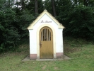
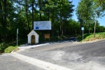
Stop 5: Chapel St. Anna
Two-hundred years old village chapel between Radošice and Mladý Smolivec. About history of Mladý Smolivec and its parts, especially Radošice.
St. Chapel. Anna
Chapel of St. Anna Radošice between the village and the mainframe community Mladý Smolivec soon reaches two hundred years of its existence. She had been built 1831. The necessary correction had done in the late 19th cent. Čížkovský priest Jan Cerny. Other fixes passed in 1926. After World war II shabby and unkempt disappeared from 1945 - 1955. Saint Anne is the patron of the chapel radošické square on the day of her holiday village Radošice regularly celebrated pilgrimage. The current replica dates from 1993 - 94. Its restoration to ensure citizens of Radošice.
Mladý Smolivec community and its parts
Mladý Smolivec Village is a municipality of the first type and has five local districts Smolivec Young, Starý Smolivec, Dožice, Radošice and Budislavice. The municipality Young Smolivec is varied, the ratio of natural elements and civilization is not very balanced. The village is situated between the natural parks Brdy a Pod Christmas in the higher elevations of southern pobrdje.
Area of the municipality's total 3040 ha, population 31. 12. 2012 was 697 The number is NUTS 4 CZ0324 Plzeň-jih, code 558061 BTU, administrative arrangements are: District - South, ORP, authorized local authority and planning authority Nepomuk, Nepomuk Land Registry Office (31 3rd 2013), Land Office Plzeň-jih, registry Office Kasejovice. Biogeographic region: contact 1.22. Pilsner, 1.29 Blatenský, Plánický 1.41, 1.42 Brdy.
Young Smolivec Village is located in the southeast of the Pilsen Region Pilsen district - south, the area is on the border of three counties of South (: District), Central (Pribram district) and Pilsen (district Plzeň south). Young Smolivec is located 38 km southeast of Pilsen, 35 km northeast of Klatov, 30 km northwest of Strakonic, 20 km north of Horažďovic, 20 km northwest of Blatna, 11.5 km east of Nepomuk, 8.5 km northeast of Oselce, 6.5 km northwest of the environs, 6 km N from Kasejovice. The northern part of the Mladý Smolivc interferes Brdy mountains to a height of 700 mn ski hill Vrchy. Nearly stream runs through the center of the region Lomnica, here called Smolivecký stream. Hilly ridge with an altitude of 600 meters above sea level forms the western part of the region, southeast of Smolivecka the other hand, consists of the valley that leads to Blatné. The local area is hillier.
The prehistory Podbrdsko and Brdy Mountain is written much in the work of researchers Frederick Dubský "Prehistory of South Bohemia," which describes the many findings documenting the Slavic settlement and burial in the basin Lomnica and Skalice of 7 century. There is an interesting description of the archeological site in the nearby Kocelovice sites of mounds budislavské by the road from Mladý Smolivce to Přebudov. This site was examined by Hykeš and Siblík (a native of Mlůadý Smolivc). In Brdy landscape was very scattered population, settlement progressed very slowly. The area gradually was inhabiting by tribe the Buzic´s, they took over the space between Březnice, Rožmitál, Teslin and Poříčí, which were established as a village. Erb with boar's head, which is now in the character of the village Mladý Smolivec, and that was in character Buzic, won Dětřich, a member of the Buzic family. It tells about it already Dalimil´s Chronicle. (Kabátník, 2000).
In all probability we can assume the existence of individual villages Mlady Smolivec area at the time of construction of the local religious and aristocratic buildings, in the 12th and 13th century. In general, the existence of settlements recognized as documented in written records. Municipalities Mladý Smolivec, Starý Smolivec, Radošice, Dožice and Budislavice were for many years the typical vassal settlements. None were ever dominant above others. In 60th years of the last century was the center of these communities concentrated in the Mladý Smolivce. The reason was the merger of government in order to obtain greater funds for investment and social events, to a large extent; this was the establishment of an agricultural cooperative based in Mladý Smolivec.
History and monuments of the village Radošice
The emergence of community Radošice dates back to 1542. The first known owner of Václav Zmrzlík, owner of Orlik, Březnice and Lnáře. He left the village to enter into renewed state records. In 1577 he sold Chanovským village of Long village and give it to associate Dožice estate. In the 17th century, the village was still seven sold and in 1676 became the property of the estate Lnáře. In 1924 the local court and land belonging to the court under the Land Reform Act dismembered. In 1654 there were 11 farms, one villager, four gardeners, two deserted cottages, 1 mill and 1-mill. In 1748 it was 18 farms, 2 crofters, 1 blacksmith, 1 weaver, 1 miller, 1 municipal shepherd and 1 again. In 1770, 36 houses were numbered descriptive and one hundred and fifty years later, the village has lived here 69 and 406 residents. The first school was built in 1875, the second in 1911. It was closed in 1975. From 1901 until year1967 worked here amateur theater, from the 19th century. There was a savings bank. On the square, next to the chapel of St. Anne in 1831, is a municipal building with clock tower, completed on 30. 9. 1939. Next to the chapel is a memorial to the fallen of the First World War. The Radošicům include extensive forests.
Obec Mladý Smolivec, Mladý Smolivec 95, 335 01 Nepomuk, telefon: 371 585 145, ou@mladysmolivec.cz
webdesign: Spinao s.r.o.


